
Ancient Kamiros: A Practical Guide to the Ruins on Rhodes

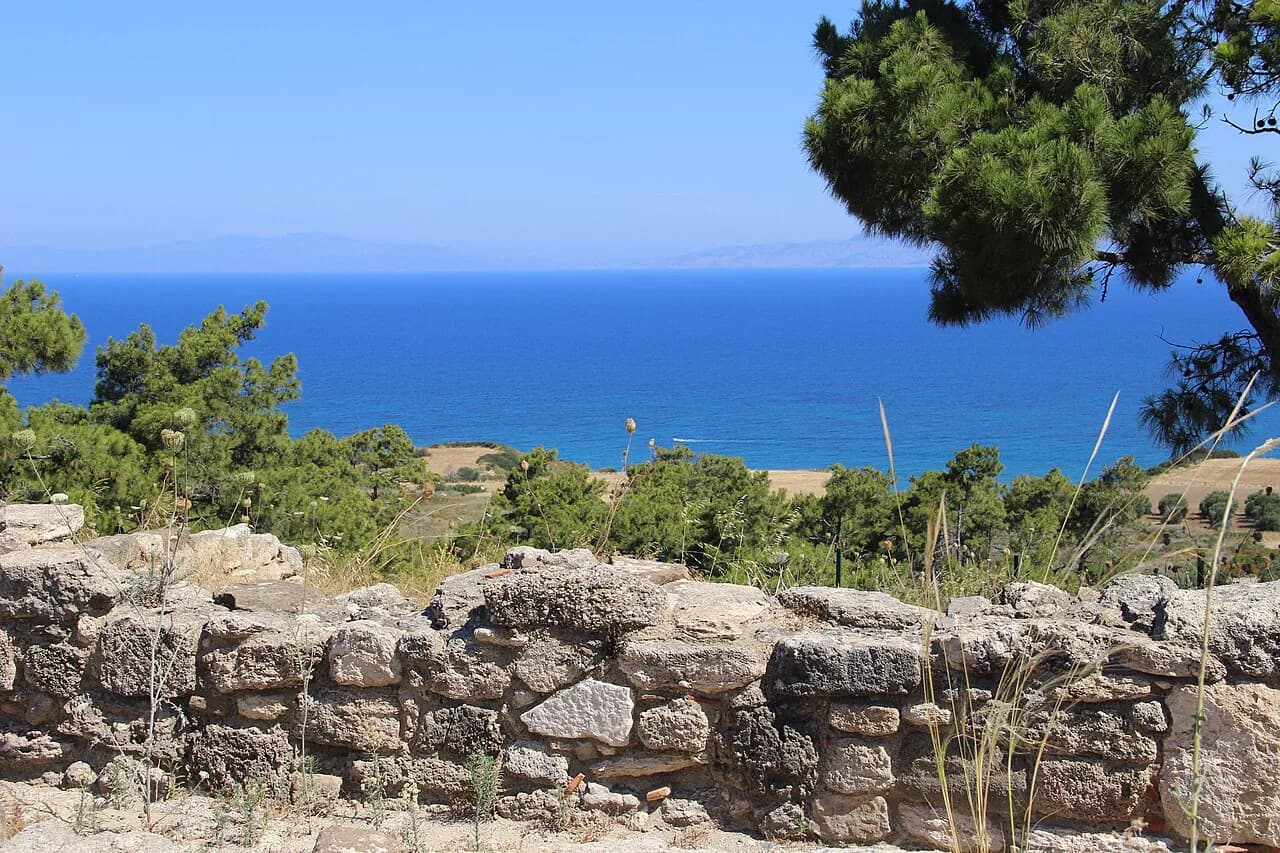
Ancient Kamiros was one of the three original Dorian cities of Rhodes and the smallest of them, yet its ruins are the easiest of the three to read. The town was not fortified and was laid out on a hillside above the sea, so the civic square, the houses and the sanctuaries sit in plain view of each other rather than being buried under later building. That legibility is the reason to put it near the top of a west-coast day.
The site suits travellers who want archaeology without a crowd and are willing to drive. It does not suit anyone expecting shade at every step, lifts, or a museum on site: the finds from the cemeteries are in Rhodes Town, not here. Plan it as a half-day outing with a stop on the coast or in the mountain villages on the way back.
What Ancient Kamiros Is and Why It Matters
Kamiros (Κάμειρος, also written Kameiros or Camirus) flourished from the Archaic period into late antiquity and was, by the ancient accounts, the smallest of the three Dorian settlements that eventually combined to form the city of Rhodes in 407/8 BC. It was named after a grandson of the nymph Rhode and Helios. Its wealth came from the land around it, above all from oil and wine, and that surplus supported a local pottery industry.
Two events explain most of what you see. An earthquake in 226 BC destroyed much of the town, and the visible masonry above ground is largely the rebuilding that followed, which is why a Hellenistic stoa sits over an older cistern. The other is water: the town survived on stored rain, distributed through a network of conduit channels, and every courtyard you walk through was built around that system.
Where It Is: West Rhodes, Above the Coast
The site sits on the west coast of Rhodes, roughly thirty kilometres southwest of Rhodes Town and above the road that runs along the shore, near Kamiros village. It is built into a slope looking seaward rather than on a high defensive crag. A guide listing puts it about thirty-three kilometres from the city centre and around eighteen kilometres from the airport, so allow driving time rather than treating it as a quick stop.
The town's harbour problem is worth knowing before you look down at the water. Its own harbour, Mylantia, was shallow and exposed, so Kamiros may also have used a more protected port about thirteen kilometres south along the coast, near where the modern village of Kamiros Skala now sits. That difficulty helps explain why the town was willing to join the new city of Rhodes with its superb ports.
Getting There from Rhodes Town and the Airport
Most visitors arrive by car, taxi or scooter along the west coast road, because the site is off the main resort strip and not within walking distance of Rhodes Town or the airport. The access road turns in from the shore and climbs through olives and pines to the entrance and a car park. If you are driving yourself, fill up before you leave the coast; services thin out on the west side.
Public buses and organised excursions do serve the area, but schedules and pickup points change by season and operator, so confirm them directly with the bus operator or the excursion provider rather than relying on an old page. The listing that gathers practical notes on the site puts it at roughly thirty-three kilometres from the centre of Rhodes Town and about eighteen from the airport.
Opening Hours and Tickets
Hours vary by season, and the published timetables do not always agree. One detailed source gives longer summer hours of roughly eight in the morning to half past seven in the evening from April to October, shorter winter hours from November to March, and closure on Mondays. Because the pattern is seasonal rather than fixed, check the culture ministry listing or the site's own notice board for the week you travel, especially around public holidays.
Ticket arrangements have been reported inconsistently, with one guide quoting a six-euro adult entrance fee and listing reduced rates for EU visitors over sixty-five, students and under-eighteens, while another listing treats the site as free. Prices and concessions change and the exact figure belongs at the ticket window, so ask at the entrance or check the official culture ministry page rather than budgeting from a travel listing. Bring valid photo ID if you intend to claim a concession.
Reading the Layout: Agora, Houses, Acropolis
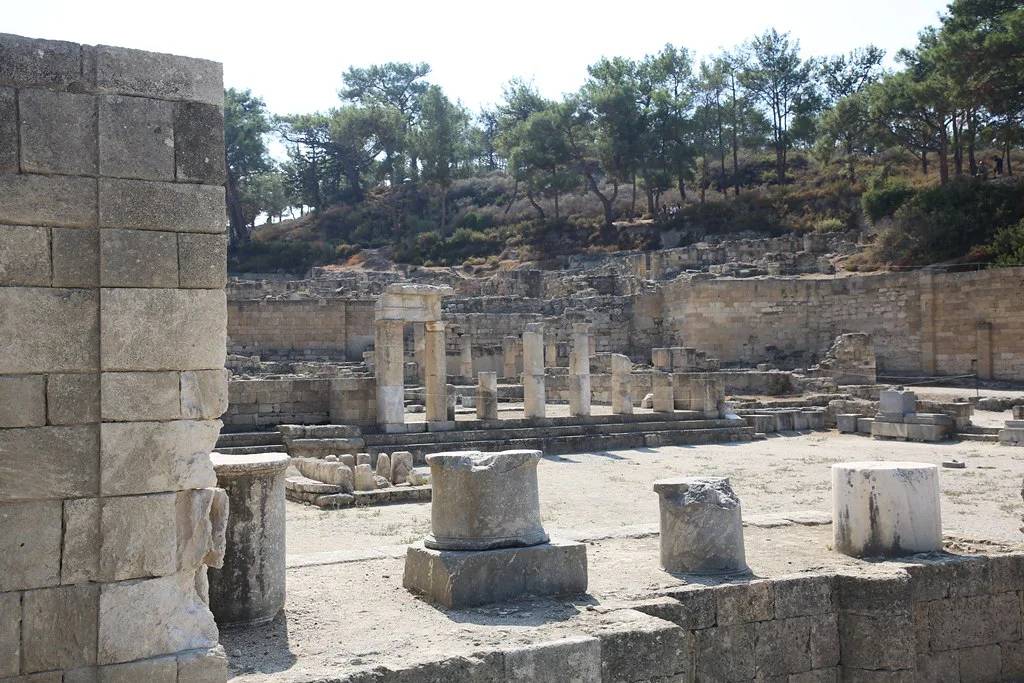
The path takes you in at the level of the ancient civic and commercial centre, where the town's flat, artificially levelled agora opens out. Sacred and administrative buildings crown the hill above, and the residential streets are laid out between the two rather than pushed to a suburb. This arrangement is why the site reads so clearly: from the entrance you can see the whole shape of the town and decide whether to work up to the ridge first and explore the houses on the way down.
At the entrance level, look for the small temple with two re-erected columns, probably dedicated to Pythian Apollo, and the later Roman house with bright coloured plaster still in an apsed room. Beside these is the Fountain Square, once a public fountain of five half-columns and later converted into an open sanctuary; its surrounding bases carry legible inscriptions naming local officials. Much of the site remains unexcavated, and archaeologists have not yet located a theatre or substantial fortification walls.
The Water System and the Archaic Cistern
Water is the theme that makes these ruins more than a set of foundations. The town stored its water in an Archaic cistern of the sixth century BC, cut with two flights of steps and capable of holding about six hundred cubic metres, and distributed it through a network of roughly 174 underground conduits. The cistern was later bisected by the wall of a Hellenistic stoa, so you can see two building phases in a single cut of stone.
In the houses, the water story becomes domestic: stone water jars, courtyard fountain bases and cistern mouths appear at nearly every turn. Guides often point out that the sound of running water would once have filled the streets; standing in the dry channels, it helps to imagine the terrace rather than simply photograph it. Wear shoes with grip, because the paths run over loose tiles and old channel edges.
The Upper Town and the Temple of Athena
At the top of the stepped main street, a broad open summit opens out. The largest surviving structure here is a Hellenistic stoa over two hundred metres long, built after the earthquake and fronted by a colonnade that crossed the old cistern. The remains of the Temple of Athena Kameiras, last rebuilt after 226 BC, occupy the same ridge, with the base of the temple and an altar visible near the southern edge.
The north side of the stoa turns its back on the town and opens onto the islands, which is why ancient officials used it for business on hot days. Plan your route to climb here early if you want the view without the glare: the north face is the only reliably cool side. On the way down, take the residential lanes rather than retracing the main street.
The Residential Quarter
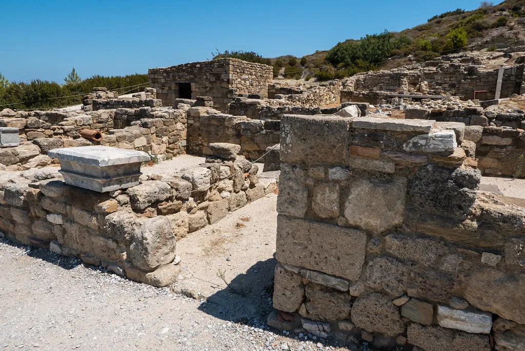
The housing is the part most visitors underrate. As in other Hellenistic towns, the houses are built around an open peristyle courtyard with a single door onto the street, and several peristyle columns have been re-erected on their bases. In the rooms off the courtyard you can pick out the details that make a town feel lived in: stone jars, small millstones, braziers of volcanic rock from Nisyros, statue niches and the paved impluvia that caught rain.
The stepped main street is the spine of this area and the best place to understand how the town sloped. The drain under the street survives, partly modified by excavators, and the walls between the houses are narrow enough that the quarter feels dense. Do not skip the lower terraces, where a side track gives a view back over the terracing and a large exedra that may have been a nymphaeum.
How Much Time to Allow
For the site alone, a focused visit takes about an hour to ninety minutes following the entrance square, the houses and the summit in order. If you read the inscriptions, photograph the views and sit on the ridge, allow two to two and a half hours. The archaeology is not enormous, but it is exposed and the paths are uneven, so a rushed visit ends up as a slog rather than a walk.
Time your visit around the heat. There is shade in the entrance square and under the trees, but the upper ridge is open, and at midday the sun is unforgiving. A morning arrival gives you the softest light for the sea view and leaves the afternoon for the coast road, a beach stop or the mountain villages inland.
Nearby Stops That Fit the Same Day
Kamiros beach lies about a kilometre from the site and is the obvious place to cool off afterwards if you are travelling by car. Further south, Kritinia Castle is roughly fifteen kilometres away and Monolithos Castle about forty, so either one makes a natural second stop on the west coast rather than a detour. If you are returning towards Rhodes Town, the old town's medieval streets are a separate half-day; the Palace of the Grand Master of the Knights of Rhodes and the Street of the Knights (Odos Ippoton) in Rhodes Old Town give that a shape.
The finest finds from the cemeteries around Kamiros went to the large museum in Rhodes Town, while a smaller selection from the area, including the gravestone of Kritos and Timarista, is in the Archaeological Museum of Rhodes. A short add-on in Embonas, in the wine country inland, suits anyone driving back via the mountain road; the archaeological museum is the right stop if you want the portable finds in one place. If this site decides where you sleep, the area-by-area breakdown in Rhodes Neighborhoods helps you weigh the west coast against the old town.
Practical Checks Before You Go
Bring more water than you think you need, wear closed shoes with grip and carry sun protection; there is little shelter on the ridge and no shop inside the site. A hat and a layer for the wind on the summit are worth the luggage space. If you are relying on a bus or an excursion, confirm the pickup point and return time before you go.
Check opening hours and holiday closures no more than a week before you travel, because the seasonal timetable and Monday closure are the two details most likely to derail a day. Note that hours and ticket rules on the ground can be updated at short notice, so a phone call or a visit to the culture ministry listing is more reliable than any older guide. Keep cash and a card as backup for the entrance.
Where to Eat Afterwards
There are no verified tavernas named here near the site, so plan your meal around the two reliable options on the return route. The coast at Kamiros Skala and the villages along the shore give you a simple choice of fish tavernas and coffee stops, while Embonas inland is the better bet for a slower sit-down meal in the wine country. Phone ahead in low season or arrive during the normal lunch window.
If you are building a longer stay around the island, the attraction guides and neighbourhood notes for Rhodes will help you slot Kamiros into a west-coast day without crossing the island twice, and the area-by-area breakdown in Rhodes Neighborhoods: 5 Area Guides helps you pick where to base yourself. The old town's palace and the hilltop site at Lindos are further away, so treat them as separate outings rather than add-ons to the same afternoon.
Explore more Rhodes sauna guides
Frequently Asked Questions
What is Ancient Kamiros and why is it worth visiting?
Ancient Kamiros was one of the three original Dorian cities of Rhodes and the smallest of them, laid out on a hillside above the west coast. Its appeal is legibility: the civic square, the sanctuaries and the houses sit within sight of one another, and the water system of cisterns and conduits is visible at almost every step. It is a quieter alternative to the island's better-known archaeological sites.
How far is Ancient Kamiros from Rhodes Town?
It sits roughly thirty kilometres southwest of Rhodes Town on the west coast, above the coast road near Kamiros village. A guide listing puts it about thirty-three kilometres from the city centre and around eighteen kilometres from the airport. Allow extra time for the slower west-coast roads.
How do you get to Ancient Kamiros?
Most visitors drive, take a taxi or join an excursion, because the site is off the resort strip and not walkable from Rhodes Town. Buses serve the area, but schedules and pickup points vary by season and operator, so confirm them with the bus company or excursion provider before you rely on them.
How long does a visit to Ancient Kamiros take?
A focused visit takes about an hour to ninety minutes if you follow the entrance square, the residential quarter and the summit. Allow two hours or more if you read the inscriptions, take photographs from the ridge and sit for a while. The paths are uneven and the upper ridge is exposed, so build in short breaks.
What are the opening hours and ticket prices for Ancient Kamiros?
Published hours and ticket rules have varied between sources and by season, and at least one source lists shorter winter hours and closure on Mondays. Check the culture ministry listing or ask at the entrance for the current timetable and price, and bring photo ID if you want to claim a concession.
What can you see at Ancient Kamiros?
Look for the small temple probably dedicated to Pythian Apollo, the Fountain Square with its inscribed statue bases, the Archaic cistern of about six hundred cubic metres, the long Hellenistic stoa and the remains of the Temple of Athena Kameiras. The residential quarter adds peristyle courtyards, stone jars, millstones and braziers of volcanic rock from Nisyros.
What is near Ancient Kamiros?
Kamiros beach is about a kilometre away, Kritinia Castle roughly fifteen kilometres, and Monolithos Castle around forty kilometres. Embonas in the wine country inland makes a good return route. Finds from the site's cemeteries are held in the museum in Rhodes Town rather than on site.
Is Ancient Kamiros accessible for people with limited mobility?
The site is uneven, with steps, loose tiles and exposed paths across a slope, and the sources used here do not describe any adapted routes or facilities. Ask the site staff about the easiest entrance route before buying a ticket, and consider visiting in the morning when the ground is cooler and less crowded.